Michael Thompson's Australian
Storm Chase Diary
Thunder Downunder
2005 - Day 1, 25th November 2006
Central West Slopes and Plains
All photos clickable for larger size
 |
 |
|
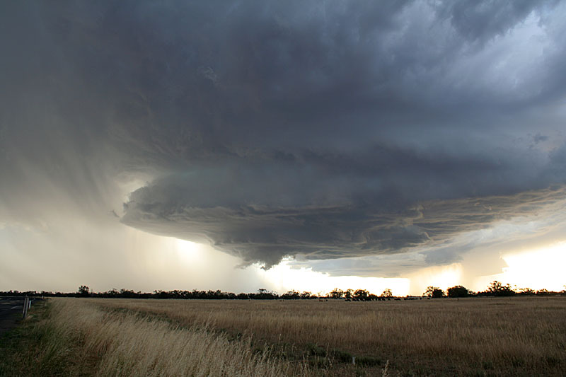
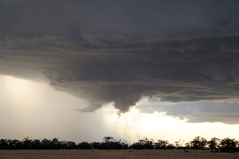
This
storm was rotating slowly - note the very nice separation between
rain and updraft. West Wyalong, NSW
|
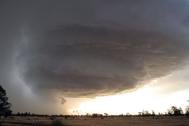
Taken
about 15 minutes later, rotation is more deeper.
|
The first day of Thunder Downunder 2005 was looking good with at last some moisture in North to North East winds ahead of a substantial cold front for inland New South Wales. Middle to upper temperatures were dropping and drying out. Shear was marginal but enough for interest.
Our first storm of the day was south west of Grenfell. What was initially a weak multicell gained strength over the nearby ranges, and briefly organised itself. It developed a small but prominent inflow feature and at this stage the storm appeared to be headed towards sustained supercell status. We followed the storm into the small town of Goolagong were there was weak rotation right over our heads. The storm rapidly fell apart about 20 minutes, so quickly it left a hail shaft in clear blue sky, we enjoyed the experience of hail falling on us whilst in brilliant sunshine.
 |
 |
|
Our
first weak multicell of the day, south west of Grenfell, NSW
|
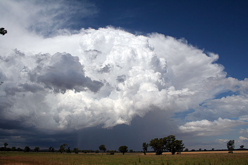
The
storm intensifies and develops organised inflow ( lower left ) -
located between Grenfell and Cowra.
|
 |
 |
|
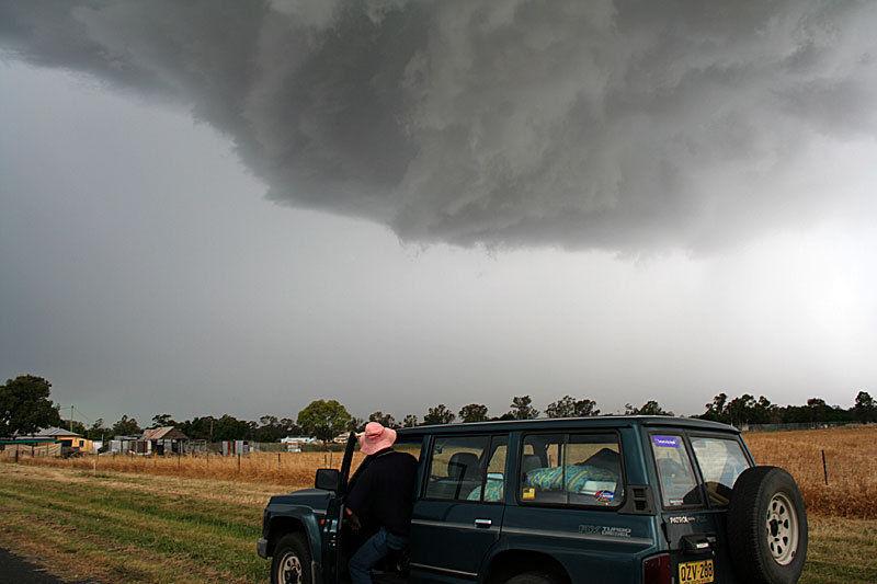
Chase
partner Michael King wisely retreats to the car with weak rotation
overhead and a couple of close lightning strikes. Goolagong, NSW
|
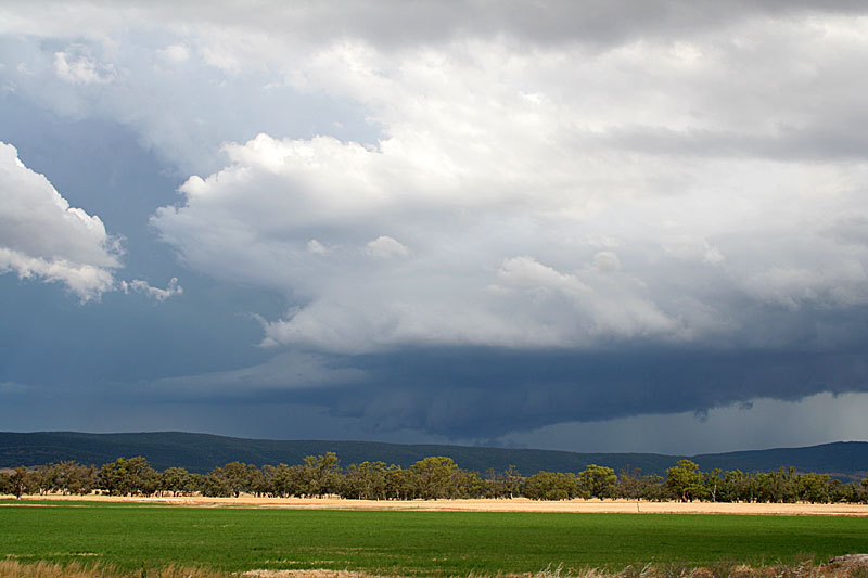
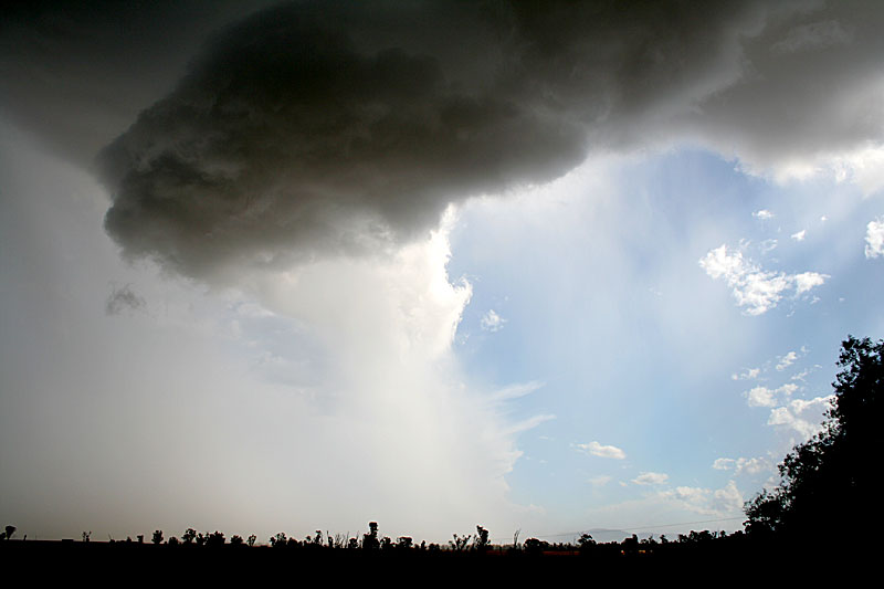
North East of Goologong the storm rapidly falls apart. A hail shaft is evident in this picture. |
After the demise of the Goolagong storm we noted that the entire sky east of us was void of any convection. We headed back west into drier surface conditions, but evidently slightly more unstable middle levels. Near the town of Forbes we watch a LP type storm struggle with the surface conditions. It had developed a small base on its SW flank, a development that was doomed to fail. Whilst we watched this storm we noticed a larger storm about 80 kilometres ( 50 miles ) SW, I noted a weak wall cloud under the updraft, but it was the explosive middle levels of the storm that interested me. Although the surface conditions struggled, the storm once established in the mid levels grew quite quickly. We intercepted the slow moving storm about 40 kilometres ( 30 miles ) NE of West Wyalong. By now convection was very isolated, in fact only three storms were left in the entire visual sky. The storm had a beautiful backlit base that showed evidence of rotation. A small wall cloud also rotated, much more quicker. We watched the storm for almost 30 minutes, the only precipitation falling was small hail from the anvil. The storm finally let out a microburst on sunset. We were treated to a nice lightning show on our journey back to Forbes where we ended Day one.
 |
 |
|
Close
up of the small, but quickly rotating wall cloud.
|
Right
on sunset a small miroburst from the storm
|