
Pictures
without time / date can be clicked on for a larger image - thanks to
Jane O'Neill for supply of some digital images
Day
7, 1st December 2000 - Gunnedah to Hastings Point, 579kms, One weak
storm, close to a severe storm.
COLD,
COLD CHANGE AND WE WERE NOT INVITED
Daylight
at Gunnedah revealed slate grey skies and a cooler south wind. This
situation was certainly not on the menu, well at least not until later.
But dinner had arrived at breakfast time so to speak. There was only
one option, to head as far NE as quick as possible to get ahead of the
trough again.
We
drove trough steady rain for the next three hours. Around 11am at Armidale
on the Northern Tablelands we encountered several storms embedded in
the rain mass. Not ideal chasing at all. In fact it was cold. At a refuel
stop at Armidale is was shivering. We pushed further north to Glen Innes,
here we at last broke out of the cool air into a sky of broken Cu with
gusty NW winds. We had some lunch at Glen Innes all the time watching
the sky. We watched several Cu develop into small cells only to be picked
up by the strong jet stream and moved east rapidly. I did not like the
situation, the cells were weak and moving way too fast to catch, further
more the NW wind was very dry. We pushed north to Tenterfield were the
situation looked even more grim, here the NW wind was warmer and there
was a complete absence of Cu northwards. I became suspicious of pre
frontal NW winds, these winds are the bane of chasing on the coast of
New South Wales during early Spring as they set up a dry line type situation
and kill off all convection in their wake ( remember on the coast we
cannot chase eastwards, so once the dryline is encountered kiss the
storms goodbye ).
FOREST
GRUMP
We received some weather updates at Tenterfield, it was a complex synoptic
situation. There were storms even 500kms south of the front triggered
by a upper cold air pool, this same pool had caused the widespread rain
and embedded thunder back southwards. The NW winds were being drawn
into and eroding the northern edge of this system. However 150kms east
on the coast the NE sea breeze was still alive. Our group decided on
the 150km dash for the coast. The road had other intentions. The 150kms
between Tenterfield and Casino is a chasers nightmare, reduced speed
corner after corner, a drop in about 1000m of altitude and a tall forest.
If that was not bad enough the road followed steep creek and river valleys.
 BACK
TO THE 70'S BACK
TO THE 70'S
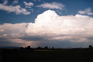
Nearing the coast at Casino we noted a line of persistent congestus
was starting to form into storms. We were about 50kms from the line
when suddenly it exploded into life with great boiling updrafts. East
of Casino and the temperature suddenly plummeted, the dry NW wind was
replaced with a cooler seabreeze and moisture. The storms were firing
on a small dryline situation. Having finally come so close our next
problem was that we had run out of chase routes, we were close enough
to see lowerings and a hail shaft, even the hear thunder, but the storms
where moving NE into hilly terrain dominated by the ancient volcanic
shield of Mount Warning. Quite beautiful being clothed in sub tropical
rainforest, but not chasing territory with poor roads winding around
steep hills and forest and hippy's from the 1970's walking down the
middle of the road. We decided what the heck and pursued the storm NE,
hoping that a storm may build slightly south of the line. We almost
caught the storms at the small village of Nimbin. Nimbin is a alternative
lifestyle area and the local crops are the types not listed on any futures
markets. After 90 minutes of scenic rainforest driving we emerged back
into open land at Murwillumbah. The storms by now were well and truly
north.
ONE
LAST GIFT
But all
was not lost we were back into humid NE seabreeze and there was convection
occurring to our west. This produced a small storm around sunset. We
followed this storm to Hastings Point on the coast where from a headland
we watched CG's about 5km away at Kingscliff. The storm was quickly
followed by another so we had about 90 minutes of activity.
The
next day was a return home trip of 890kms. In the wake of yesterdays
complex situation a SE wind had established along the whole NSW coast,
shutting down action for the whole state - for the first time in about
2 weeks !
MAPS
AND STUFF
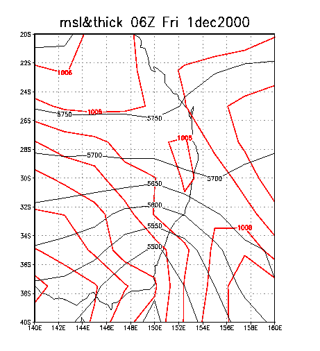
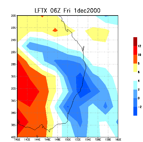
The
charts reveal that today was a major shift in weather compared to the
previous week. On the surface chart high pressure was ridging from the
west, whilst a weakening trough and front lay over the NE of the state.
Thickness was reducing over the southern half of the state with colder
and drier air spreading through the middle layers. This cooler middle
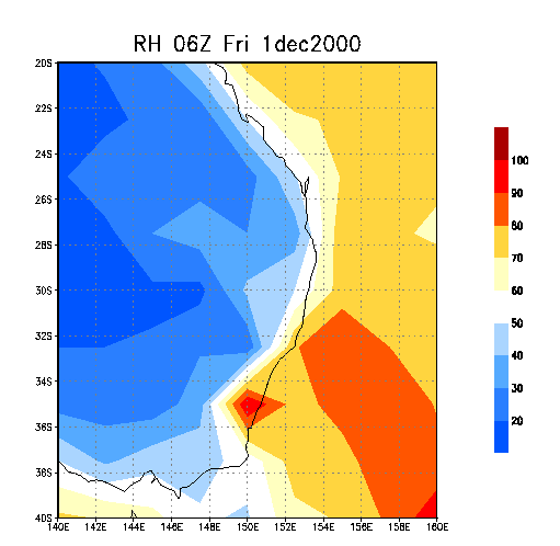
air triggered extensive cloud rain areas in the wake of the front. Further
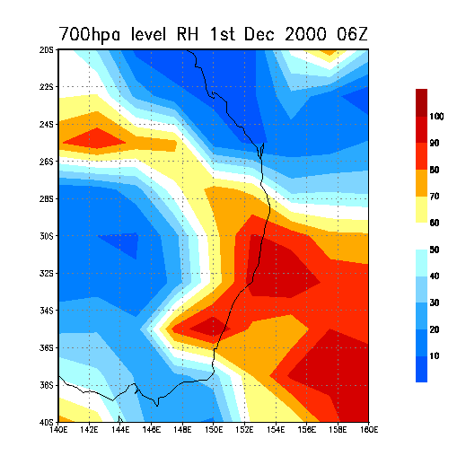
evidence of the drying can be found by comparing the 700hpa level RH
chart to that of previous days, it is almost the opposite ! Today the
best storms formed near Grafton and moved north. ( Approx 29.30S, 153E
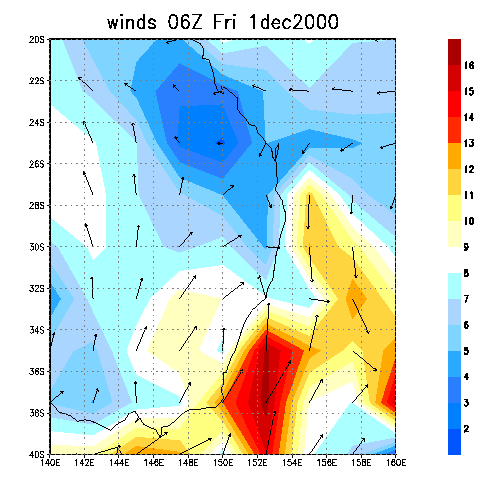
). The winds chart hints at the weak dryline situation we encountered.
If you look between 28S and 30S on the coast you will see W and NW winds
these met the seabreeze ( not marked well ) near Casino. A stronger
SE change is also moving up the coast.
  
|
