Michael Thompson's Australian
Storm Chase Diary
Thunder Downunder 2005 - Day 3, 27th November 2005
Narrabri, NSW to Maryborough,
QLD
All photos clickable
for larger size
The day two check in to our motel at Narrabri was 11pm, we were all very tied from the lightning show. Our dinner that night was at Coonabarabran where the highlight ( besides the odd rumble of thunder ) was the heckling the unfortunate local pub band was receiving from their grand audience of five.
There was no need for alarm clocks today, all four chasers were woken at once from a loud bang of thunder at 5.30am. Looking outside and the the mid levels were racing away to the NE - a sign that would set the pace for the rest of the day.
We left Narrabri with a NW wind, a trough line racing NE and lowering dew points. We passed through Moree and Goondiwindi, stopping at Inglewood in the Queensland Darling Downs to assess the situation. Convection was occurring, but so much junk it was hard to pick anything in the sky. The NW wind had picked up to around 20 knots, dew points were barely adequate, but under increasing threat. After 30 minutes or so a small storm formed north and we raced towards it. It was this initial storm that gave us a second taste of the shear we would deal with. What at first appeared an easy intercept was missed, with the storm passing east of us quickly. We estimated the storm speed at least 50-60knots. Running down a storm from behind on Australian roads was not going to be an option today.
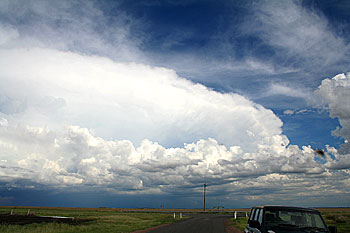
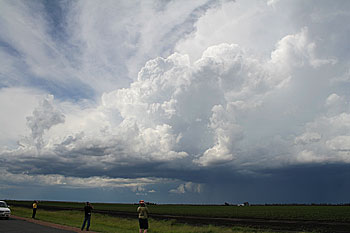
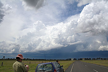
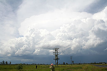
Near Pittsworth the storms began to organise better. The eastern sky was dominated by three massive storms, with a line of developing storms stretching NW aligned to the trough, which was speeding its way to a tropical vocation.
 |
|
|
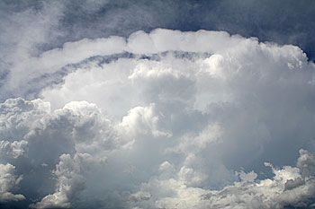
Looking
up at the updraft of one of the storms, note the collar!
|
Another
of the strong storms - possible supercells, as shear was more than
adequate. ( Powerlines removed )
|
We spent the rest of the day chasing the trough line down. At one stage a large storm developed on the end of the line that produced an anvil overhang that was perhaps two to three thousand metres thick. I have never seen anything like it. As the anvil spread it was trained down the trough line of storms. The animated satellite picture shows this strange blob progressing quickly SE along the line - it must have been a mystery for anybody who saw the satellite pictures without an explanation.
We finally gained the storms just near Kilkivan, near the aptly named Devil's Mountain. We experienced flash flooding rain and a barrage of lightning, including two strikes less than 50 metres from our cars. During a lull in the rain and just on sunset, the storm base to the east took on the most unearthly shade of blue I have ever witnessed. It was a glowing cobalt blue, to all four chasers it could only mean we had just outflanked what we suspected was a very severe storm. ( Reports of cricket ball hail in news next day ). We ended day three at Maryborough with clearing skies and dropping temperatures.
The post analysis of the wind shear shows some interesting figures - bear in mind this is GFS analysis, real conditions may have been slightly different.
|
Surface
|
*NE
|
10-15
knots
|
|
900mb
|
SW
|
30
knots
|
|
750mb
|
WSW
|
35
knots
|
|
600mb
|
WSW
|
50
knots
|
|
500mb
|
W
|
50
- 55 knots
|
|
300mb
|
W(
slight NW )
|
60
knots
|
|
200mb
|
NW
|
70-80
knots
|
The surface winds we had were NW at 20 knots, but we were outside the storms, which I am 99% sure would have been in NE winds on and ahead of the trough. So what is unusual, well the shear has a veering pattern, most common in the northern hemisphere. The shear however accounts for the movement of the line of storms we observed perfectly. It also leaves room for possible supercell storms.
