
Pictures
without time / date can be clicked on for a larger image - thanks to
Jane O'Neill for supply of some digital images Note that some in Hi
8 stills the date is 1 day fast.
Day
2, 26th November 2000 - Coonabarabran to Narrabri, 327kms, Multicell
Storms - some severe.
FRIENDLY
FARM STAY
Morning revealed some storm chasers favorite early morning
cloud - altocumulus castelanus ( Accas ). I say some as I can't bring
myself to fully appreciate this cloud, afterall back home in the Illawarra,
castelanus is more often than not seen on the wrong side of a passing
trough.
Coonabarabran
is nestled on the edge of an extinct volcanic range called the Warrumbungles.
This range is a storm magnet and often initiates the first storm of
the day, and on borderline days perhaps the only storm. Those are the
good points about chasing near Coonabarabran, there is however a flaw
and it is a big one, the area has very thick scrub and forest, so much
so that chasing along the roads in the area is frustration. We headed
east through this thick bush, home of the infamous yowie, Australia's
answer to bigfoot. Every now and then we had glimpses of congestus to
the south, we dearly wanted to assess this interesting area. In the
middle of nowhere Clyve suddenly pulled over and darted up this dirt
track. Some chasers have a natural instinct in these situations, and
Clyve is one. Less than 500m up this dirt track and the forest opened
out into a neatly groomed farm. The view was superb. Even
better the farmer was very friendly and let us drive up into his farm
which afforded sweeping views to the south over the Warrumbungle ranges.
The farmer mentioned that his property is very lightning prone, he had
recently lost 20 sheep to lightning strikes and loses 2-3 trees a year.
The track was narrow and recent rains had left it in a muddy state.
Despite this the convoy of four cars made it to a high dry ridge where
we had a cup of tea, threw some rocks and generally waited and watched.
As
the morning wore on the Accas burnt off and congestus took over. It
appeared that convection was strongest in the same area as yesterdays
first storm, so we headed back to Tambar Springs. The sky was full of
try hard towers, but there was a reasonable cap so we leisurely had
lunch at the very small town of Premer. Premer is the sort of town you
would find only on the most detailed and local scale maps. There was
the obligatory pub, a general store and a rusty train track.
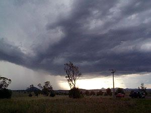 OUT
ONTO THE PLAINS OUT
ONTO THE PLAINS
After lunch we headed about 10 minutes east of Premer
and onto the wide and treeless Breeza plains. We pulled over at a small
creek, under normal circumstances it would have been dry, but recent
floods ensured a healthy flow. The younger chasers were intrigued by
huge carp trying to scale a small cascade.
At
2.30pm first glaciation occurred to the west, within 30 minutes as often
is the case several other storms had broken cap as well. The largest
of these was eastwards. It had a solid rain shaft and small rain foot,
we decided to chase. It was soon clear we were following the storm from
its weaker flank, being a non severe storm we drove through it, the
roads were very poor and gravel surface, the storm although small had
enough heavy rain the cause some minor flooding. I felt for the other
chasers sliding around in their cars, whilst I simply engaged 4WD on
my wagon. The storm moved further east away from roads, it was not severe
and as such the loss was not mourned.
WESTWARD
HO
A decent
line of towers back to our west became our next target, we encountered
these from a perfect vantage just west of Gunnedah, in several minutes
the storm went from a rain free base to having a heavy rain core. There
were some nice CG's and a rainfoot to photograph, we backed back a couple
of times to keep ourselves in optimal position. Eventually the storm
moved into inaccessible areas. We tried a 150km hook in an attempt to
intercept it again near Narrabri, but by now it was late and the storm
weakened.
We
spent the night in Narrabri, a town that suffered badly in the recent
floods and now was battling a mosquito plague. In fact the town had
sold out of repellent for the critters. We had a BBQ dinner that provided
a strange mix of smells, steak, sausages and mud.
We
later learnt that another storm brought down trees and power lines back
at Premer.
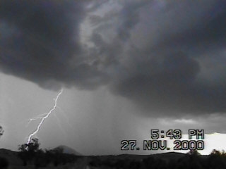 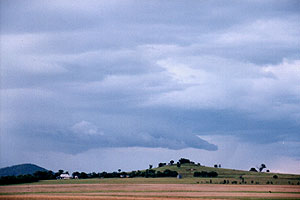
The
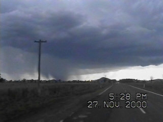
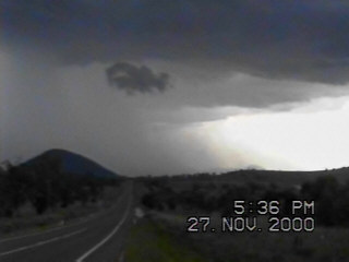
two images below demonstrate just how quickly these storms put out microbursts,
note the time stamp on the video stills is only 8 minutes apart. The
road here is dead straight. The small hill in image 1 is the same as
the the hill in image 2, and in the lightning image above too. Note
that the date is one day advanced.
TO
DAY THREE
MAPS
& STUFF
Another
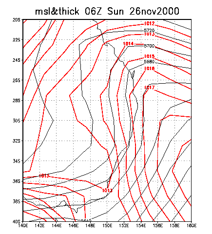
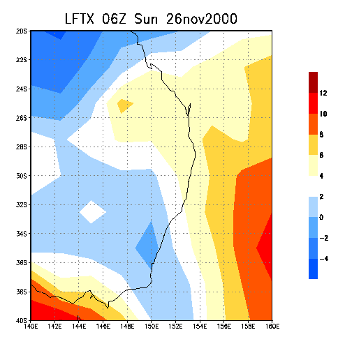
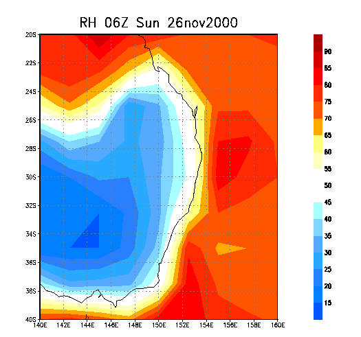
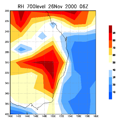
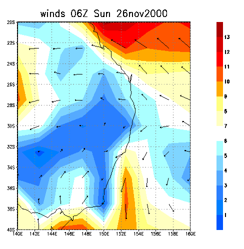
day of rather unimpressive charts, except for the relative humidity.
A weak surface trough over the SE of New South Wales is shown on the
MSL chart, but the Queensland ridge is the dominant feature. Lift Index
figures are a bit ' rubbery ' I find that the true figure is often another
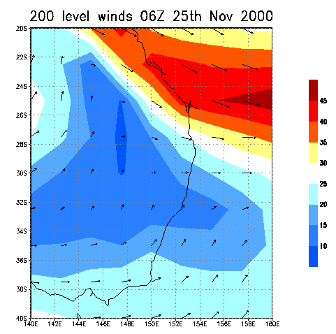
-2 lower, as was the case this day. 200 hpa level winds were of little
consequence. However the clue to the microburst situation can be found
be looking at the two relative humidity charts below. The surface level
( 1000 ) one has a figure around 30%, we found it to be just a little
higher, but the 700 level has the RH skyrocketing to over 80%, aiding
wet microbursts.
  
|