Storm Chase Tour - Sept
& Oct 98.
PART
1 - Despair as the death ridge from hell
kicks in.
 For
several months Jimmy Deguara of Australian Severe Weather had been trying
to organise a group chase for the 1998 season. The only dates suiting
many of the interested parties was during the University and School
holiday break of late September to early October. Ideally to chase in
November / December would be more productive, but the target area of
the Northern Tablelands of New South Wales has produced many severe
September storms. It was a gamble, one that was lost in the first week.
Had the chase been started one week later we would have had supercells
and tornadoes. For
several months Jimmy Deguara of Australian Severe Weather had been trying
to organise a group chase for the 1998 season. The only dates suiting
many of the interested parties was during the University and School
holiday break of late September to early October. Ideally to chase in
November / December would be more productive, but the target area of
the Northern Tablelands of New South Wales has produced many severe
September storms. It was a gamble, one that was lost in the first week.
Had the chase been started one week later we would have had supercells
and tornadoes.
Conditions on day one, the 26th September 1998 were
looking slightly optimistic, there  was some instability in the middle layers of the
atmosphere, and the MRF model in particular was predicting some light
shower activity just over the border into Queensland. Joining the chase
this week was Jimmy Deguara, Paul Graham, Paul Yole and Michael Thompson.
We pinned hopes in the south east Queensland trough triggering some
storms and decided to move as far north as possible on day one. The
total trip for the day was around 600 kilometres ( 350 miles ). Near
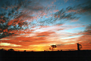
the small town of Uralla we witnessed a superb sunset. We stayed the
night in a small truck stop motel at a place called Black Mountain,
at an altitude of 1350m ( 4500ft ). was some instability in the middle layers of the
atmosphere, and the MRF model in particular was predicting some light
shower activity just over the border into Queensland. Joining the chase
this week was Jimmy Deguara, Paul Graham, Paul Yole and Michael Thompson.
We pinned hopes in the south east Queensland trough triggering some
storms and decided to move as far north as possible on day one. The
total trip for the day was around 600 kilometres ( 350 miles ). Near
the small town of Uralla we witnessed a superb sunset. We stayed the
night in a small truck stop motel at a place called Black Mountain,
at an altitude of 1350m ( 4500ft ).
The next morning was cool,
unfortunately all trace of the middle layer instability had cleared.
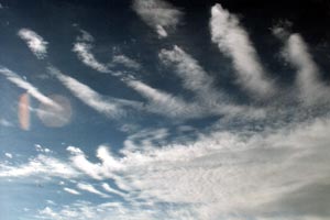
Early in the morning there was fast moving stratocumulus  from the west associated with upsloped air, we had
some small hope that this may burn off and cumulus develop during the
day.Mid morning we visited the small city of Armidale (
that in September 1996 had been hit by baseball sized hail and downburst
winds) to check the internet models. The prognosis was very poor,
there was a weak surface trough in south east Queensland, but the jet
streams were converging over eastern Australia, aiding a persistent
high pressure that was ridging all the way back from near New Zealand.
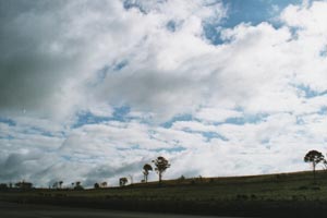
By noon the stratocumulus had burnt off and small cumulus had developed
from surface convection, but it was capped tighter than a soda bottle.
We put our slim hopes on the weak surface trough and drove another 200
kms ( 120 miles ) northwards to the small town of Tenterfield. Conditions
to the north looked visually poor so we decided to quit for the day
and sought accommodation. With a couple of hours to kill until sunset
some of us took a run eastwards to the eastern escarpment, from the west associated with upsloped air, we had
some small hope that this may burn off and cumulus develop during the
day.Mid morning we visited the small city of Armidale (
that in September 1996 had been hit by baseball sized hail and downburst
winds) to check the internet models. The prognosis was very poor,
there was a weak surface trough in south east Queensland, but the jet
streams were converging over eastern Australia, aiding a persistent
high pressure that was ridging all the way back from near New Zealand.
By noon the stratocumulus had burnt off and small cumulus had developed
from surface convection, but it was capped tighter than a soda bottle.
We put our slim hopes on the weak surface trough and drove another 200
kms ( 120 miles ) northwards to the small town of Tenterfield. Conditions
to the north looked visually poor so we decided to quit for the day
and sought accommodation. With a couple of hours to kill until sunset
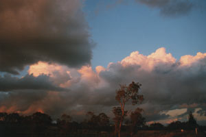
some of us took a run eastwards to the eastern escarpment,  the best cumulus development had occurred on the
weak seabreeze front, which by 6pm had penetrated inland to the escarpment,
but again it was well capped.If nothing else it made a colourful photo. the best cumulus development had occurred on the
weak seabreeze front, which by 6pm had penetrated inland to the escarpment,
but again it was well capped.If nothing else it made a colourful photo.
With the poor outlook we decided
to sleep in the next morning. Mid morning we again checked the internet
models, the situation was getting worse, the ridge had strengthened,
although the weak surface trough in south eastern Queensland still persisted.
The Queensland Bureau of Meteorology was forecasting afternoon showers
east of the trough, with this small hope we pushed further northwards
into Queensland.
 The
town of Stanthorpe in Queensland is the only part of that state were
snow can occasionally fall, the area is blessed with rich soils and
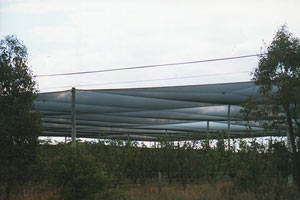
stone fruits and apples are grown in the area. Hail is that common in
Stanthorpe that many orchards are covered with hail nets, and believe
it or not the local farmers still swear by their ' hail cannons'. Unfortunately
none of these devices were to be needed this week. We decided that pushing
further into Queensland would be futile and called it a day. We filled
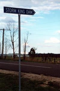
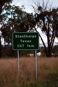
the rest of the day taking silly photos such as the Texas and Storm
King Dam road signs. ( the Queensland town of Texas has recorded a tornado
). The
town of Stanthorpe in Queensland is the only part of that state were
snow can occasionally fall, the area is blessed with rich soils and
stone fruits and apples are grown in the area. Hail is that common in
Stanthorpe that many orchards are covered with hail nets, and believe
it or not the local farmers still swear by their ' hail cannons'. Unfortunately
none of these devices were to be needed this week. We decided that pushing
further into Queensland would be futile and called it a day. We filled
the rest of the day taking silly photos such as the Texas and Storm
King Dam road signs. ( the Queensland town of Texas has recorded a tornado
).
  Tuesday the 29th September 1998, and the charts
and models looked dreadful, the shallow Queensland trough had disappeared,
and the high pressure ridge had consolidated, upper atmosphere was also
poor with full on convergence over us. Michael Bath of Australian Severe
Weather who unfortunately could not come on the chase had christened
the situation as the ' Death ridge from Hell ', indeed it was producing
some early spring heat in southern Australia with Sydney aiming for
a record run of over 30C ( 86F ) days. The chase team decided to stay
put and went for a 150km ( 90 miles ) drive eastwards to the world heritage
listed Washpool National Park, this park contains several different
rainforest zones from sub tropical to cool temperate. There was some
cumulus development on the escarpment edge but it was capped. On our
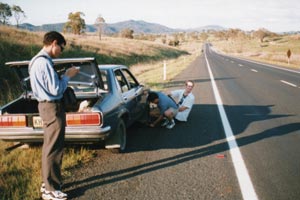
return to Tenterfield Jimmy's car suffered at flat tyre. Tuesday the 29th September 1998, and the charts
and models looked dreadful, the shallow Queensland trough had disappeared,
and the high pressure ridge had consolidated, upper atmosphere was also
poor with full on convergence over us. Michael Bath of Australian Severe
Weather who unfortunately could not come on the chase had christened
the situation as the ' Death ridge from Hell ', indeed it was producing
some early spring heat in southern Australia with Sydney aiming for
a record run of over 30C ( 86F ) days. The chase team decided to stay
put and went for a 150km ( 90 miles ) drive eastwards to the world heritage
listed Washpool National Park, this park contains several different
rainforest zones from sub tropical to cool temperate. There was some
cumulus development on the escarpment edge but it was capped. On our
return to Tenterfield Jimmy's car suffered at flat tyre.
If yesterdays prospects were bad, today's were worse,
the Death ridge from Hell was very much alive and was dominating all
weather over eastern Australia. We drove southwards back to Armidale
from where we checked the internet. The models suggested that some activity
may develop later in the week along the New South Wales / Victorian
border, almost 1500km ( 900 miles ) from Armidale. We  discussed the options and
decided to push southwards in the hope that the weather may meet us
somewhere down the track in the next two to three days. One thing was
certain, staying in Armidale was only useful for a suntan. At 4pm in
Tamworth we had a roadside discussion, Tamworth was situated at the
junction of three major highways, we had two options, the first to gamble
on the weather and take the Oxley Hwy westwards, then the Newell Hwy
southwards, this would commit us to two to three days on the road in
anticipation, or secondly to basically postpone the chase and head back
to Sydney that night and wait for better weather. We decided on the
Sydney option and reached home about midnight. discussed the options and
decided to push southwards in the hope that the weather may meet us
somewhere down the track in the next two to three days. One thing was
certain, staying in Armidale was only useful for a suntan. At 4pm in
Tamworth we had a roadside discussion, Tamworth was situated at the
junction of three major highways, we had two options, the first to gamble
on the weather and take the Oxley Hwy westwards, then the Newell Hwy
southwards, this would commit us to two to three days on the road in
anticipation, or secondly to basically postpone the chase and head back
to Sydney that night and wait for better weather. We decided on the
Sydney option and reached home about midnight.
The next few
days vindicated our choice, the ' Death ridge from Hell '
gave Sydney its record run of plus 30C ( 86F ) days, and
no activity occurred in New South Wales or Queensland.
Saturday,
October the 3rd and at last the ' Death ridge from Hell '
was breaking up. A weak cold front was pushing into New
South Wales and afternoon thunderstorms were a slight
possibility for Sydney. With two chasers from Victoria in
Sydney it was decided to have an informal chasers meeting
in Sydney, the venue chosen was Rooty Hill, from where we
could keep an eye on the weather during the meeting. The
meeting went well, the weather just did not do it, the
lasts gasps of the ' Death ridge from Hell ' keep
humidity less than 30%, winds were strong from the North
West. Late in the day some cumulus developed off the
coast in the far south east, this held promise for
tomorrow.

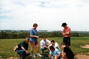
Some
Australian chasers - from left to right CLYVE HERBERT, Geelong, Victoria. Michael
Bath, Sydney, New South Wales. David
Croan, Sydney New South Wales, Darren Heys, Sydney, At
laptop, Jimmy Deguara from
Sydney, New South Wales. Sitting Paul Yole
from Murtoa, the Wheat fields of Western Victorian. Paul
Graham, Sydney, New South Wales. Photo
taken by Michael Thompson, Shellharbour, New South Wales.
CLICK
HERE FOR TOUR MAP
PART 2 - Some action at last, but
bad timing yet again.
COPYRIGHT: All
photos on this and my other pages are copyright of Michael Thompson.
However use for any non-profit purposes can be had in most instances
by simply E Mailing first.
  
|
